
Where does My Water Come From?
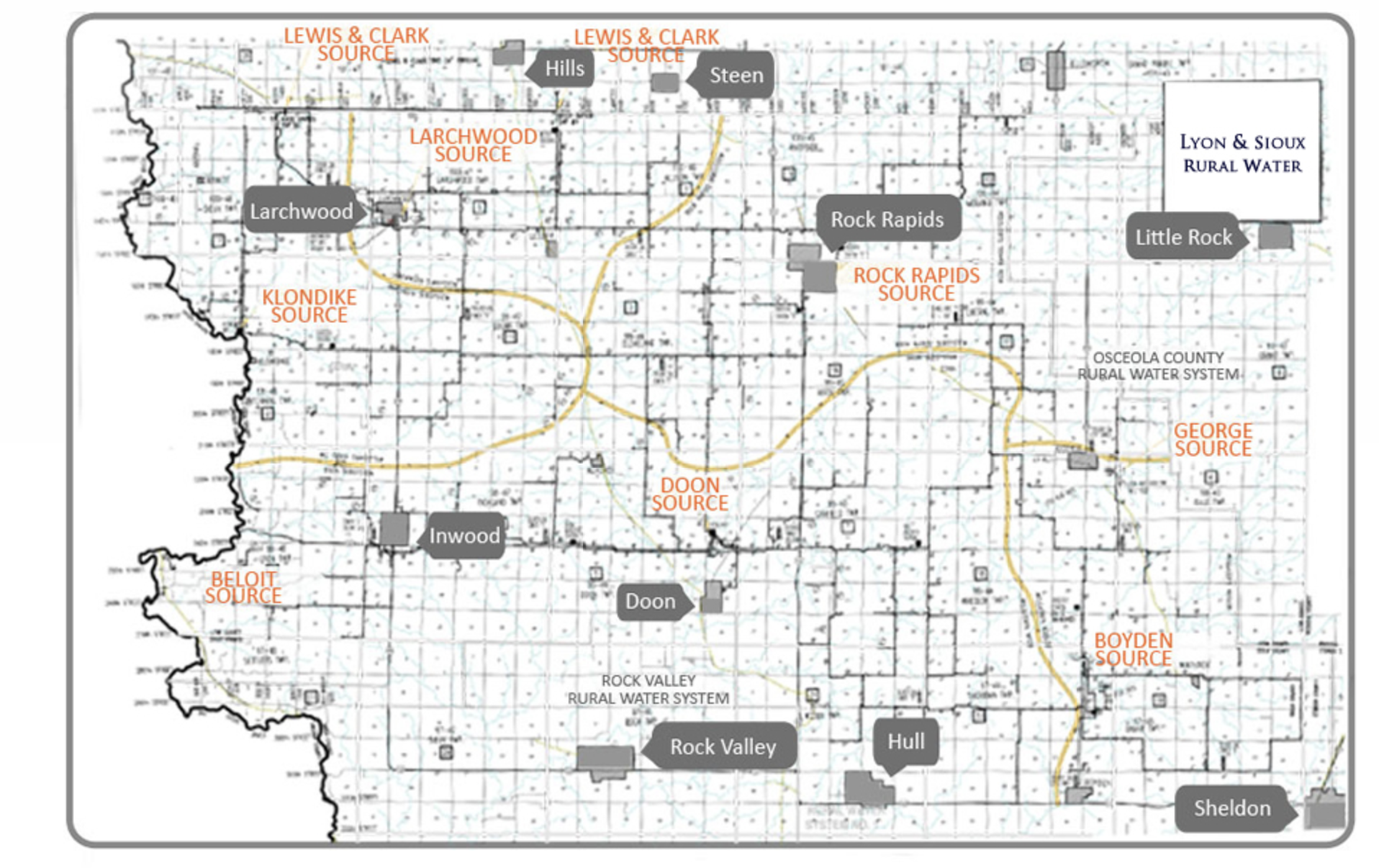
The map below shows our water coverage area including the water sources. If you’re unsure which source your water comes from or would like more information, contact our office for assistance.
Roll over the area you live to see information below the map about your water source.
Service Area Interactive Map
Big Sioux Subsystem
The Big Sioux Subsystem has 2 treatment plants. The Klondike plant is along the Big Sioux River and has 6 shallow wells that service the west part of our System. The Larchwood plant is located in the town of Larchwood and is supplied water from 3 deep wells (700 ft). This plant serves the area south and east of Larchwood, and the towns of Larchwood and Lester.
Doon Subsystem
The Doon Subsystem has a water treatment plant 1 ½ miles north of Doon. This plant utilizes 12 alluvial wells and serves the area west of Doon, all the way to the Big Sioux River, and east to the George/Boyden Blacktop. It also serves the towns of Alvord, Doon, and Inwood. The Doon Wellfield is our best and biggest source of water. We added 2 new wells near Beloit in 2012. These wells will be used as a supplemental source for the area southwest of Inwood during the summer months.
Rock Rapids Subsystem
The Rock Rapids Subsystem purchases water from the City of Rock Rapids. It serves the area east, west and north of Rock Rapids.
Boyden Subsystem
The Boyden Subsystem also has 2 sources. The George water treatment plant is just east of the town of George and has 5 shallow wells serving the surrounding area. The Boyden water treatment plant is located 2 ½ miles north of Boyden. We have 7 alluvial wells that provide water for this plant which serves the area east of the George/Boyden Blacktop and south towards Sheldon. Also, it serves the towns of Boyden and Matlock.”